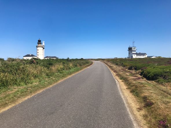

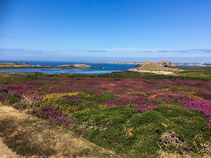
Purple heather and bracken make for an attractive vista on the trip from the port to the only village.
We had taken the ferry on a cloudless calm day from the pretty fishing village of Camaret-sur-Mer for a day trip to the wild Ushant Island, the most western point of France, lying 41 kilometres off the coast of Brittany.
The conquering Romans named this area the Finestère, or "the ends of the Earth", truly thinking they had reached the edge of the world.
Today, Ushant is inhabited year-round by a very hardy population of just over 800 people, who mainly reside in Lampaul, the only village on this 7km-long mass of treeless rocky land.
After the 1½-hour boat trip, we climbed the steep stairs to the top of the stone wharf at Stiff Port. The tides here are some of the largest in the world and can vary by an astonishing nine metres.
The port is protected from the open ocean by high cliffs and massive concrete and stone walls. In spite of this, it can be inaccessible for days during the legendary winter storms that thrash Ushant.
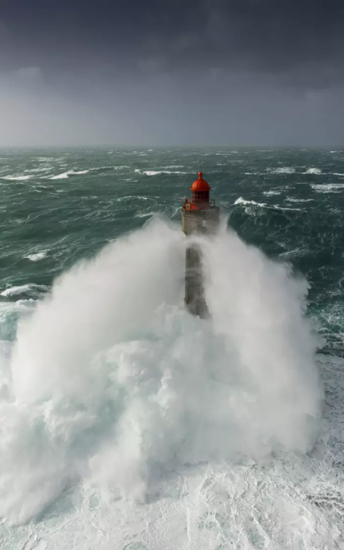
A string of enormous lighthouses around the island protects passing ships from the treacherously strong currents and quickly changing weather that characterise the area.
The ferry to Ushant Island leaves from Camaret-sur-Mer on the mainland.
The size of Ushant makes it perfect for exploring for a day. The only cars on the island are those that belong to the locals, but a bus service is in place to transport people the 4km from the port to Lampaul.
Upon request, taxi and bus tours can also be arranged to see the rest of the island in comfort.
We fixed our sights on renting bicycles for the day from one of the many rental stands set up at the port exit. There are a number of options available, from traditional bikes to electric, also with the possibility of renting wagons to carry smaller children in.
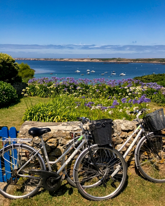 Standard and electric bikes are available for hire near the port exit.
The smooth roads make for easy riding, and we quickly coasted into Lampaul through the purple heather and bracken-covered landscape sectioned off by low stone walls and dotted with squat whitewashed, thatch-roofed houses.
After a stop at the bakery to buy sandwiches and pastries for a picnic, we cycled out to the western finger of Ushant for an unmissable visit to the Lighthouse and Beacon Museum (la Musée des Phares et Balises), housed in low buildings surrounding the 47m-high, black-and-white-striped Créac’h Lighthouse, which is still working.
Here, you can learn about the incredible challenges the builders of the lighthouses experienced, and understand the true fortitude of the locals.
Ushant was once known as “The Island of Women” because the female inhabitants worked alone on shore while the men were out fishing for months at a time. They often perished at sea.
The toughness of the local women is personified in the true story of Rose Héré, who one stormy night in 1903 plunged into the raging waters to save 14 shipwrecked sailors.
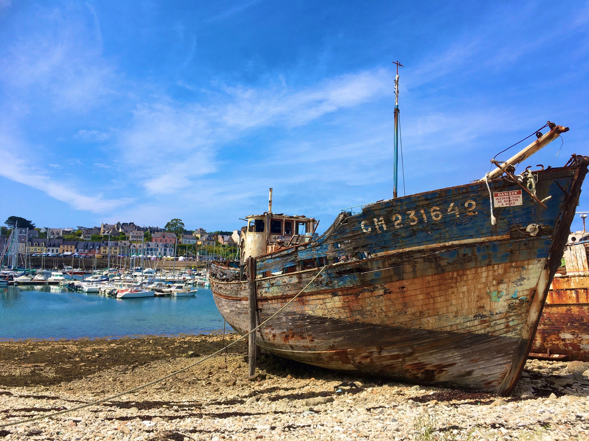
On calm days, centuries of shipwrecks that litter the sea floor all around Ushant can be glimpsed from the high cliffs in parts of the island.
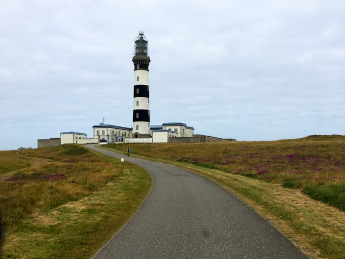 Créac’h is one of a string of lighthouses that warn passing ships of the treacherous currents.
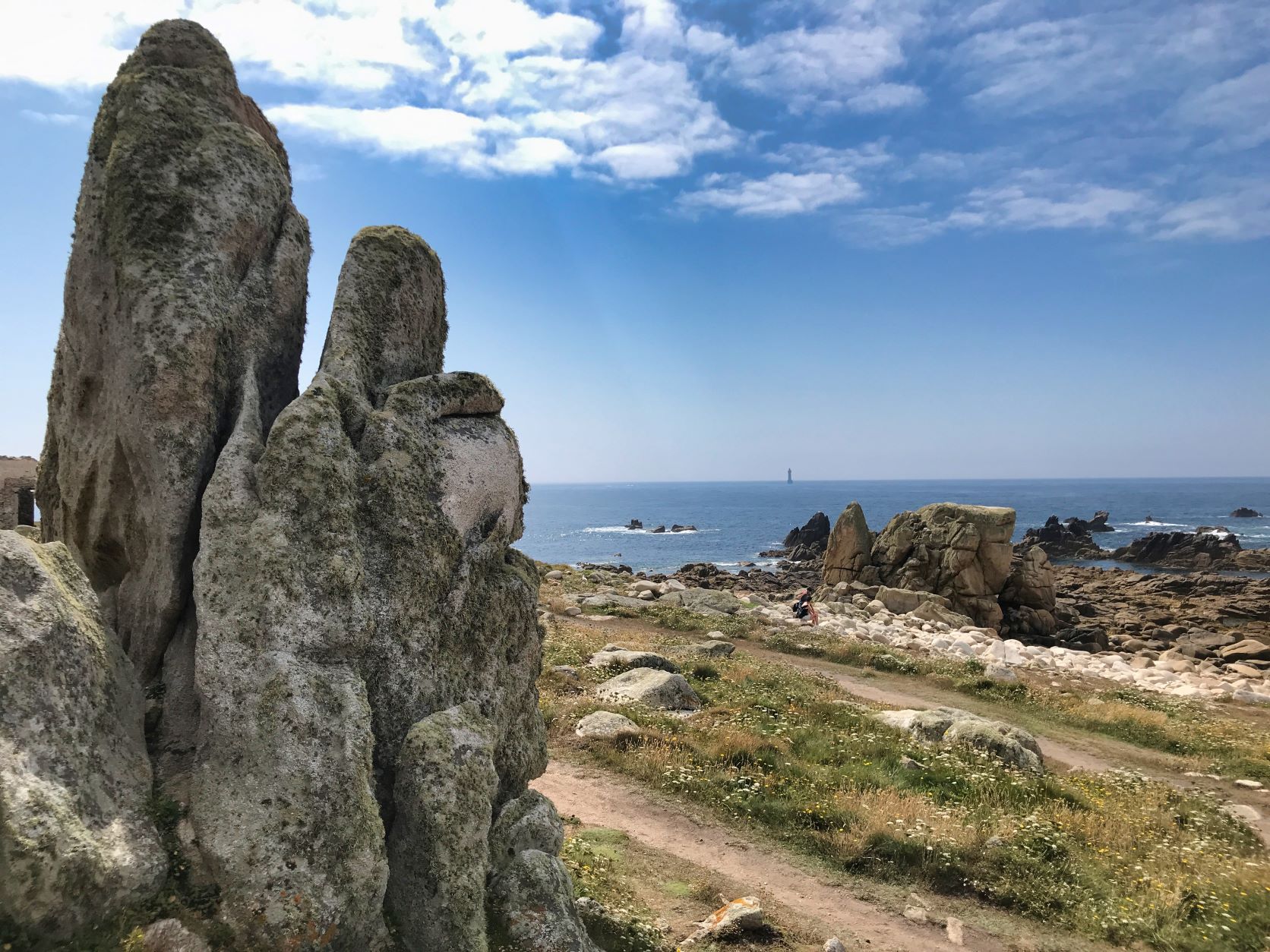
After getting our fill of lighthouse history, we stopped for a picnic at Pointe de Pern, the absolute westernmost point of France. In calm weather, sit on the rocky headland and gaze out at Nividic lighthouse, now run automatically but once accessible by a small cable car.
Explore the ruins of the base station, and contemplate the difficulty in building the lighthouse, and the pylons out to sea that supported the cables.
If the wind is as strong as it usually is, shelter behind one of the many large rock formations along the beach and watch the heaving waves crashing onto the shore.
 After Pointe de Pern, the next picnic spot to the west is in England.
On our way back to the port, we took a detour to Penn ar Ru Meur, an extremely wild cape of formidable cliffs plunging into the deep transparent water.
Just across a small channel – within swimming distance for the foolhardy – is the privately owned Keller Island. It boasts just one dwelling, on its high point, surrounded by grassy plains, and is a favourite spot for oystercatchers, turnstones, black guillemots and cormorants.
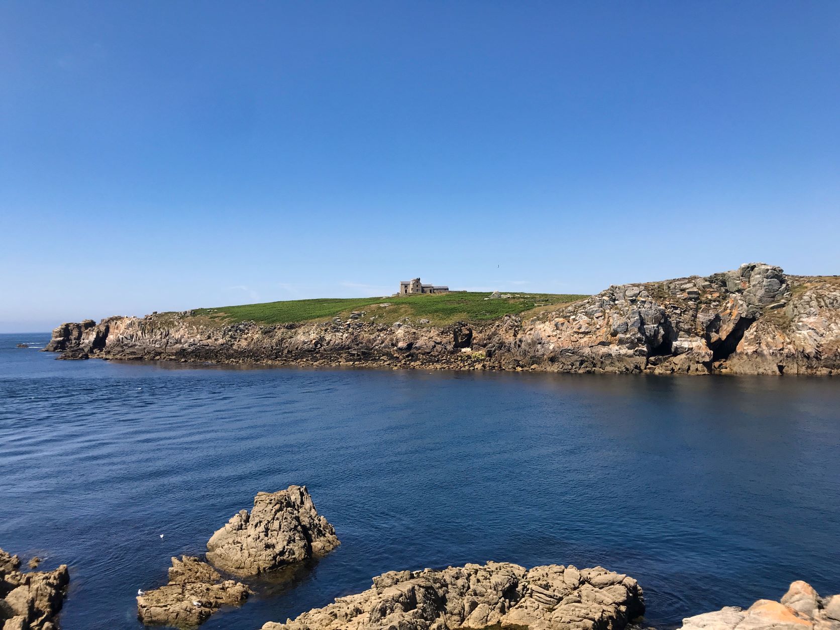 Keller Island is known to ornithologists for its rich birdlife.
 Just like the Romans thousands of years ago, a trip to this far-flung, mystical island really made us feel as if we had journeyed to the ends of the Earth.